Many of the Llano Canyons’ most special places are rarely seen. They are behind pad locks and barbed wire. After a decade of documenting the hidden beauty of the Texas Panhandle canyonlands, there are still a few such places left unseen. Some of these locales, in my mind, render this meager blog incomplete in their absence from the pages of adventure stories and photographs below. Until now, most of the beautiful waterfalls in South Cita Canyon were such places.

South Cita Creek is a 7-mile long tributary of the Palo Duro Canyon system. In the autumn of 2013, my oldest daughter and I shared a memorable day hiking Ceta Canyon, a church camp that occupies upper South Cita. On that hike we explored and photographed a waterfall in the glorious backdrop of a bright blue cobalt sky and yellow cottonwoods. The waterfall we visited that day in November 2013 is called First Falls, although most Panhandle residents simply know it as Ceta Falls. Many camp goers have fond spiritual memories of this legendary Caprock gem. In fact, Heaven only knows how many young souls have been impressed by its cool flowing waters- literally! Unbeknownst to most campers, this locally popularized landmark is nestled in the upper portions of South Cita Canyon, and is only the first of five waterfalls that few even know exists. When my family and I left Amarillo in 2015, I had all but given up on ever seeing the lower falls of South Cita Canyon. Patience, however, is a virtue when your passions include accessing private land in Texas! As luck, persistence, and time would have it, doors (or I should say, gates?) eventually opened.
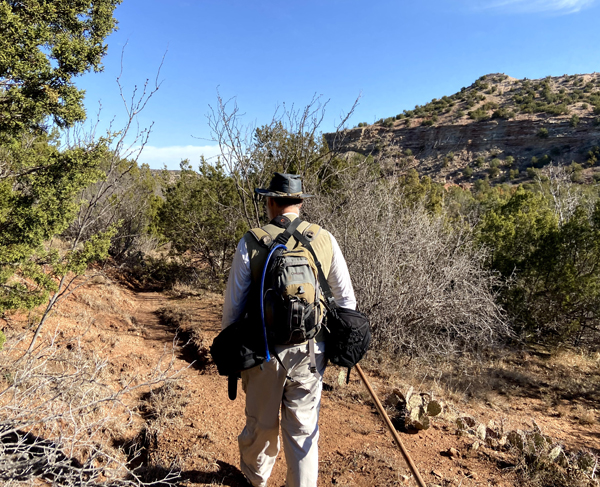
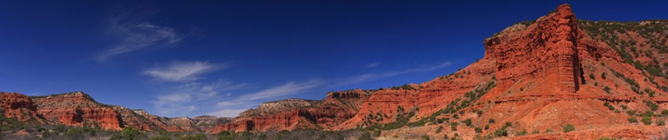
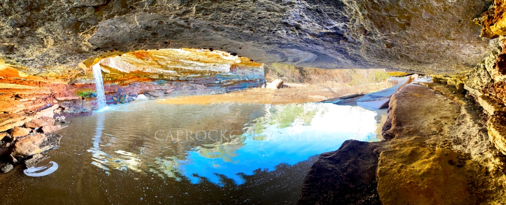
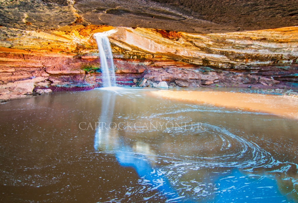
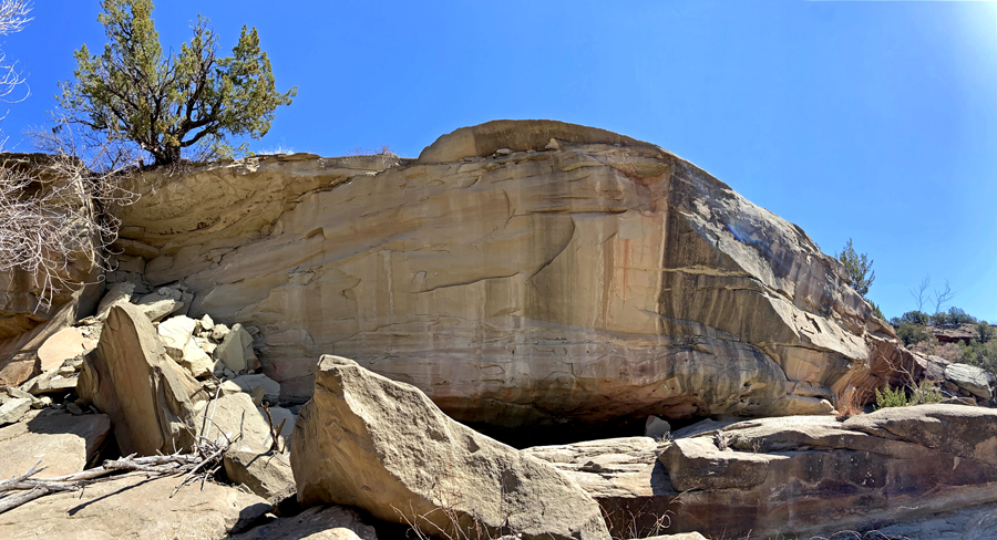
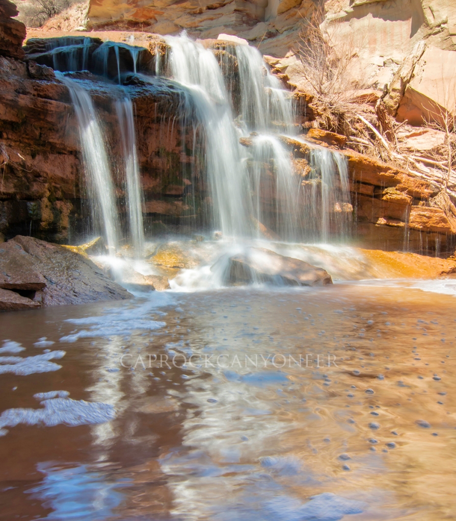
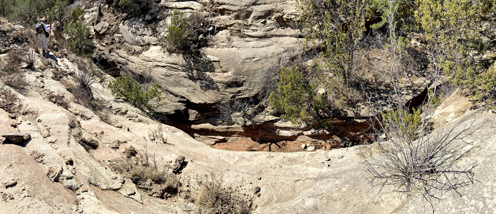
We began the day from a point on the rim overlooking the valley of South Cita Creek. From there, we descended one of the many old abandoned and disrepaired ranch roads that can still be found along the canyon’s edge on private ranches. It was along these roads from which cedar posts harvested in the canyon were transported to the Plains above for fencing. Bary, (Nerdy Native) led the way along a relatively gentle one-mile route that guided us from the rim to a broad v-shaped outcropping of Trujillo sandstone where the mainstem of South Cita Creek sharply drops in what has historically been called “Third Falls”. For past generations, it is rumored this waterfall and the particularly deep pool at its base surrounded by a natural sandstone ledge was a popular swimming hole. Long since forgotten by today’s modern west Texans, I have wondered if this is the famed “blue hole” referenced in the writings of Dr. Flores near the junction of the Cita Creeks. For sure that it is, I am not, but it’s beauty matches most of those descriptions, even if the geographic location seems off just a bit.
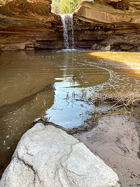
Eager to capture a particular view, I quickly scrambled down the cliffs just downstream of the falls. My primary objective on this hike was to photograph the scene from below the v-shaped sandstone shelf surrounding Third Falls. Bary, having previously hiked (with permission) to this location, had captured a beautiful image from beneath the falls, and I could not wait to attempt my rendition. As one arrives at the base of the pool below Third Falls, it is a short crawl on all fours to sneak under the expansive sandstone ceiling guarding the hidden water feature. Once below, the shelter expands to nearly five feet in height, just enough space to comfortably relax and take in the drowning but peaceful sound of falling water which echoes off of the sandstone (YouTube video clip). Upon our arrival, direct sunlight was bisecting the pool, but a stunning reflected light cast a brilliant warm glow around the glistening falls. It was truly a beautiful sight, and the panoramic images I captured here will make a brilliant companion piece for the Red Canyon images taken late last year.
From Third Falls we continued downstream weaving from one side of the stream to the other, basically following the path of least resistance on the driest ground possible. The spring season had been very active weather-wise, with severe storms and tornadoes followed by a blizzard the week prior. Vegetation along the streambed showed evidence of a recent flood, and even a few large trees were downed.
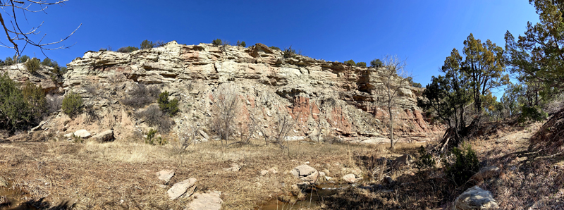
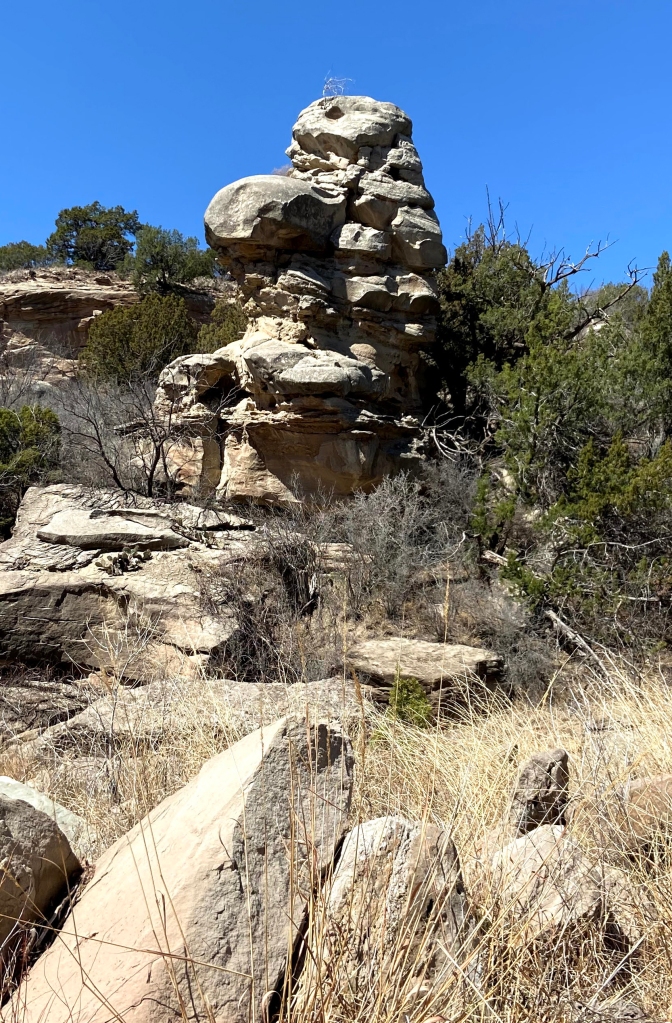
The sandstone canyon walls between Third Falls and our next point of interest, Fourth Falls, were impressive to say the least. Photos do not do this section of the canyon justice. Sheer vertical cliffs nearly a hundred feet tall lined the creek, some cut from concave-shaped Trujillo outcroppings. Earlier I mentioned the writings of Dr. Dan Flores. He once wrote about places that likely had spiritual significance to the Plains Indians. Places where nature seems to speak to you. I had never experienced that in the way I did on this hike. At one of the convolutedly contorted sandstone walls undercut by a cascading trickle of South Cita Creek, it was almost like you could hear voices echoing off of the curving stone walls – voices from the past? It was just running water echoing off of the rocks, but I repositioned myself several times on the opposing side of the creek to hear the effect fade in and out, just to make sure I wasn’t imaging it. All while my hiking partners, Bary and Dusty explored from other perspectives along the creek. I didn’t dare tell them of my experience, because it seems crazy, right?
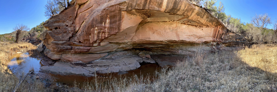
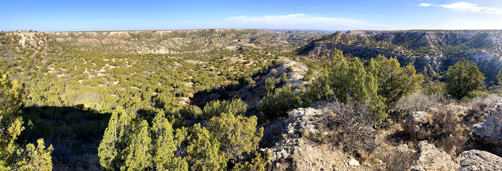
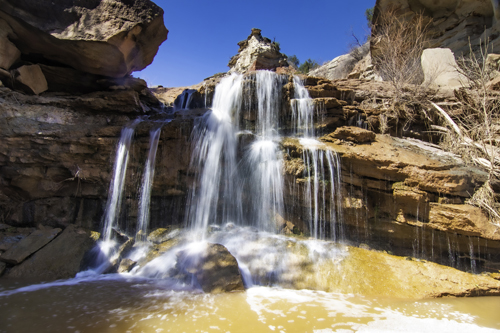
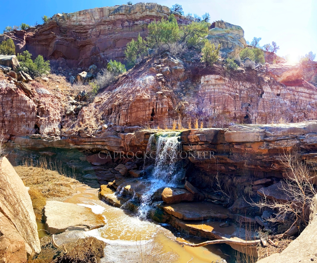
The dramatic landscape made classic west Texas canyonscapes, with massive ship-like sandstone formations rising high above meandering streams of cold, clear, cascading water. We eventually hit a place where the ground stepped down again to form the Fourth Falls of South Cita Canyon. While this is the smaller of the lower South Cita waterfalls, it is particularly picturesque (YouTube Video).
As we progressed further down the remarkable waterfall-filled canyon, a pair of golden eagles circled high overhead. Along a narrow stretch of the creek between Third and Fourth Falls, near the special place where the rocks talked to me, one of the majestic raptors walked down the creek bed before taking flight. As it did, its wing span was massive, appearing to reach across the entire breadth of the creek, which I would estimate the width of the water course to approach 8 feet in that spot! I am sure some of the apparent size could be due to perspective, but it was probably the largest bird I’ve ever seen, much less in west Texas.
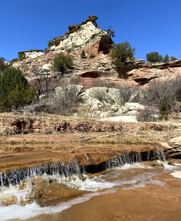
As we descended below Fifth Falls, the character of the canyon abruptly changed. Above, the canyon was riddled with Trujillo outcroppings with almost mystical shapes, including apparent cones and pyramids, but below this lower falls, the canyon was dominated by the Tecovas formation. Although we didn’t progress any further downstream, the creek bed appeared to be comprised of huge Trujillo boulders that had tumbled down throughout the millennia, and I could even see the top half of a pure Tecovas dome, or slide. This was, however, a place I had always wanted to see. The State Photographer of Texas, Wyman Meinzer, once photographed this location for his book, Canyons of the Texas High Plains. He captured it under near perfect conditions in autumn, but my view on this bright sunny spring day included harsh afternoon sun. Still, the scene was much more dramatic than I envisioned, with a castle of sandstone filling the backdrop (YouTube video clip).
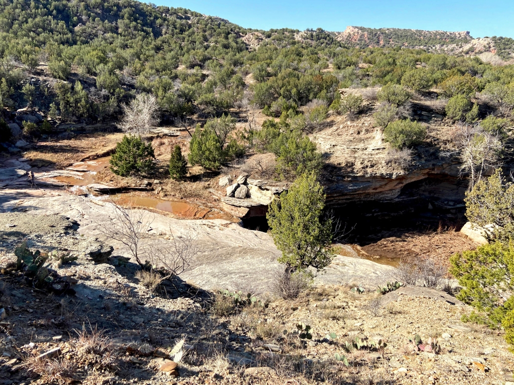
Of course, few of my hikes in the canyons of the Llano Estacado are complete without detouring to find a slot canyon. This one was no exception. On our exit route back to the rim, Bary navigated us up through a narrow side canyon which contained an uniquely green tinged and highly weathered sandstone. The canyon eventually contracted into a slot. Our passage was restricted by deep water holes, but the scene was quite photogenic.
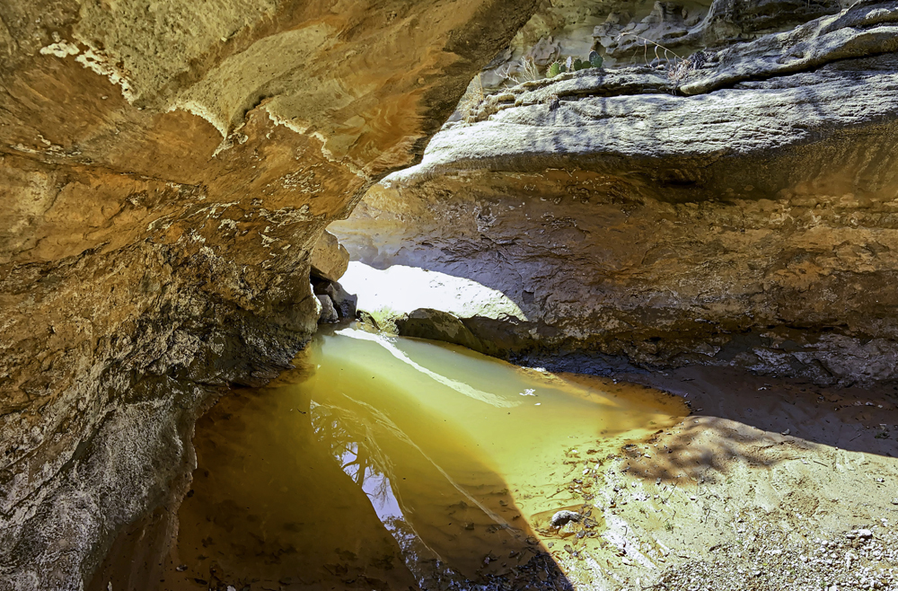
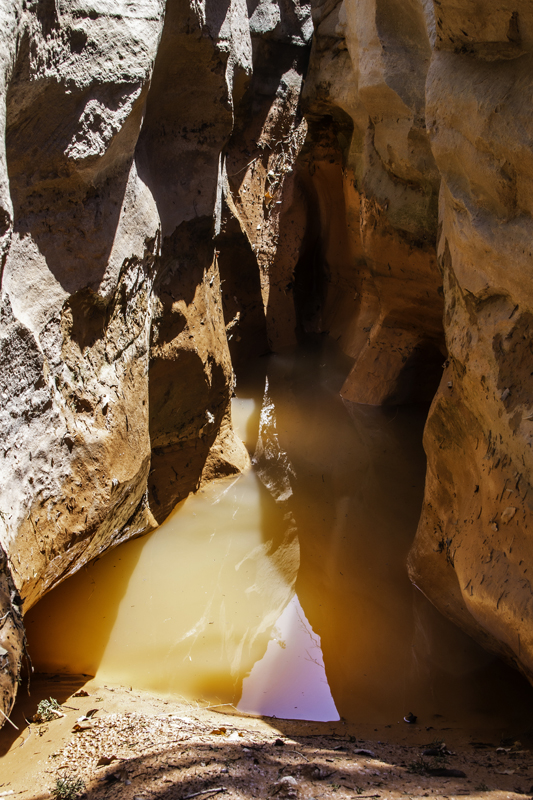
To continue our advance, we had to obtain high ground and scramble along the rim of the slot. The tightest and deepest sections of the canyon were water-filled, but I managed to stem my way over water and mud to find a suitable place to photograph the narrowest confines of the slot. This section was about six feet deep and about one to two feet wide. Once I emerged from the slot dry, well- mostly, the return ascent to the parked vehicles on the south rim of South Cita Canyon was uneventful, except for when we apparently startled a skunk along the old ranch road.
Many thanks to Bary and Dusty for inviting me to see this largely forgotten portion of west Texas’ canyon country. It has been a bucket list hike for me every since seeing the photo of Fifth Falls in Wyman’s book a decade ago. I know I have blogged about this many times, but patience and persistence really are the keys to obtaining greater access to the true natural wonders that remain largely unknown along the Caprock Escarpment.
Outdoor enthusiasts and west Texas naturalists that are interested in respectively enjoying these places and advocating for responsible access and conservation have encountered growing frustration and setbacks surrounding our few public lands in recent months. I put faith in the free market, and yes, there is a growing market for outdoor adventure in west Texas beyond big game hunting. Hopefully this blog, and other online resources, have sufficiently raised awareness that there is a whole other side to the ‘boring’ plains landscape of west Texas. Natural wonders that once defined the historic old west Panhandle culture and history were once considered worthy of placement in our coveted national park system, but have since been forgotten behind the barbed wire of private ownership. Meanwhile, administrators of our public lands tightened restrictions due to COVID-19, but also have been quietly protecting leases of those lands for profit by private agribusinesses. Attention Texas taxpayers! You have invested with your tax dollars in (and you think you have) a 26,000+/- acre public park in Palo Duro Canyon. Thanks to restrictions enforced by park law enforcement and privately employed ranch hands, you have access to less than half of that! I have faith, however, that some land owners will recognize the opportunity to diversify, and perhaps as we emerge from the pandemic, they will start looking for ways to expand their operations and income to include nature-based tourism. There are models for this now along the Caprock, including Pole Canyon Ranch, and the soon-to-open Merus venture in lower Palo Duro Canyon. In fact, perhaps someday, it will be possible for adventure-seekers to obtain permits and/or guides for amazing hikes such as this legendary stretch of waterfalls in South Cita Canyon. Doesn’t that sound more like the American way to celebrate our natural wildernesses versus the current reality in west Texas, where bureaucratic agencies entrusted with stewardship of taxpayer owned resources impose public restrictions for the mutual monetary benefit and profit of apparent tax-dodging ranching empires? My bet is that the promise of profits will gradually open gates and access to more of the long-held natural and historical wonders of the Llano Canyons. There is reason for optimism, but not all of the region’s landowners will be motivated to open for business. Some of them prefer to invest in keeping you off of the land your tax dollars have already bought and paid for!


Absolutely obsessed with your blog! Thank you for sharing all of these hidden gems!
Thank you, Molly. Stay safe!